Overview:-
- The Ob River also Obi, is a major river in western Siberia, Russia and is the world’s seventh-longest river. It forms at the confluence of the Biya and Katun Rivers which have their origins in the Altay Mountains. It is the westernmost of the three great Siberian rivers that flow into the Arctic Ocean.
Geography
- The Ob forms 25 km (16 mi) southwest of Biysk in Altai Krai at the confluence of the Biya and Katun rivers. Both these streams have their origin in the Altay Mountains, the Biya issuing from Lake Teletskoye, the Katun, 700 kilometres (430 mi) long, bursting out of a glacier on Mount Byelukha.
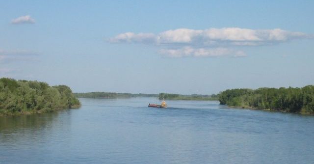
- The Ob’s entire main course is within Russia, though its tributaries extend into Kazakhstan, China and Mongolia. The river splits into more than one arm, especially after joining the large Irtysh tributary at about 69° E. (Originating in China, the Irtysh is actually longer than the Ob from source to the point of their confluence.) From the source of the Irtysh to the mouth of the Ob, the river flow is the longest in Russia at 5,410 kilometres (3,360 mi). Other noteworthy tributaries are: from the east, the Tom, Chulym, Ket, Tym and Vakh rivers; and, from the west and south, the Vasyugan, Irtysh (with the Ishim and Tobol rivers), and Sosva Rivers.
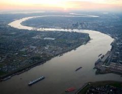
- The Ob zigzags west and north until it reaches 55° N, where it curves round to the northwest, and again north, wheeling finally eastwards into the Gulf of Ob, a 100-kilometre-long (62-mile) bay of the Kara Sea, separating the Yamal Peninsula from the Gydan Peninsula.
- The combined Ob-Irtysh system, the fourth-longest river system of Asia (after Yenisei, and China’s Yangzi and Yellow rivers), is 5,410kilometres (3,360 mi) long, and the area of its basin 2,990,000 square kilometres (1,150,000 sq mi). The river basin of the Ob consists mostly of steppe, taiga, swamps, tundra, and semi-desert topography. The floodplains of the Ob are characterized by many tributaries and lakes. The Ob is ice-bound at southern Barnaul from early in November to near the end of April, and at northern Salekhard, 150 km (93 mi) above its mouth, from the end of October to the beginning of June. The Ob River crosses several climatic zones. The upper Ob valley, in the south, grows grapes, melons and watermelons, whereas the lower reaches of the Ob are Arctic tundra. The most comfortable climate for the rest on the Ob are Biysk, Barnaul, and Novosibirsk.
Pollution
- In its early years of operation, the Mayak plant released vast quantities of radioactively contaminated water into several small lakes near the plant. These lakes drain into the Techa River, whose waters ultimately flow into the Ob River near the end of its path.
- Countries Russia
- Length 3,650 km (2,268 mi)
- Basin 2,972,497 km2 (1,147,688 sq mi)