Overview:-
- The Congo River is a river in Africa. It is the second largest river in the world by discharge (after the Amazon), and the world’s deepest river with measured depths in excess of 220 m (720 ft).
- The Congo-Chambeshi river has an overall length of 4,700 km (2,920 mi), which makes it the ninth-longest river (in terms of discharge, the Chambeshi is a tributary of the Lualaba River, Lualaba being the name of the Congo River upstream of the Boyoma Falls, extending for 1,800 km). Measured along the Lualaba, the Congo River has a total length of 4,370 km (2,715 mi). It crosses the equator twice. The Congo Basin has a total area of about 4 million km2, or 13% of the entire African landmass.
Name
- The name River Congo originated from the Kingdom of Kongo which was located on the southern bank of the river. The kingdom in turn is named for the Bantu population, in the 17th century reported as Esikongo. South of the Kongo kingdom proper lay the similarly named Kakongo kingdom, mentioned in 1535. Abraham Ortelius in his world map of 1564 labels as Manicongo the city at the mouth of the river.
- The tribal names in kongo possibly derive from a word for a public gathering or tribal assembly. Little is known about the peoples of the inner Congo, but “It is probable that the word ‘Kongo’ itself implies a public gathering and that it is based on the root konga, to gathe. The usual interpretations, admittedly unsatisfactory (Laman, 1953, p. 10), make the mistake of being too concrete; for example, they may claim that “Kongo” comes from nkongo. The modern name of the Kongo people or Bakongo was introduced in the early 20th century.
- The name Zaire is from a Portuguese adaptation of a Kikongo word nzere (“river”), a truncation of nzadi o nzere. The river was known as Zaire during the 16th and 17th centuries; Congo seems to have replaced Zaire gradually in English usage during the 18th century, and Congo is the preferred English name in 19th-century literature, although references to Zahir or Zaire as the name used by the natives remained common.
- The Democratic Republic of the Congo and the Republic of the Congo are named after it, as was the previous Republic of the Congo which had gained independence in 1960 from the Belgian Congo.The state of Zaire during 1971–1997 was also named after the river, after its name in French and Portuguese.
Basin and course
- The Congo’s drainage basin covers 4,014,500 square kilometres (1,550,000 sq mi). The Congo’s discharge at its mouth ranges from 23,000 to 75,000 cubic metres per second (810,000 to 2,650,000 cu ft/s), with an average of 41,000 cubic metres per second (1,400,000 cu ft/s).
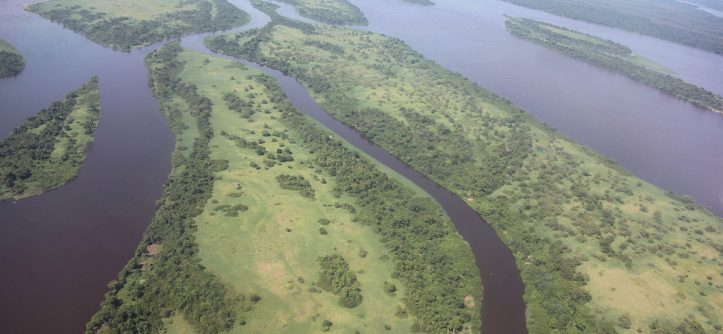
- The river and its tributaries flow through the Congo Rainforest, the second largest rain forest area in the world, second only to the Amazon Rainforest in South America. The river also has the second-largest flow in the world, behind the Amazon; the third-largest drainage basin of any river, behind the Amazon and Plate rivers; and is one of the deepest rivers in the world, at depths greater than 220 m (720 ft). Because its drainage basin includes areas both north and south of the equator, its flow is stable, as there is always at least one part of the river experiencing a rainy season.
- The sources of the Congo are in the highlands and mountains of the East African Rift, as well as Lake Tanganyika and Lake Mweru, which feed the Lualaba River, which then becomes the Congo below Boyoma Falls. The Chambeshi River in Zambia is generally taken as the source of the Congo in line with the accepted practice worldwide of using the longest tributary, as with the Nile River.
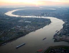
- The Congo flows generally toward the northwest from Kisangani just below the Boyoma falls, then gradually bends southwestwards, passing by Mbandaka, joining with the Ubangi River, and running into the Pool Malebo (Stanley Pool). Kinshasa (formerly Léopoldville) and Brazzaville are on opposite sides of the river at the Pool, where the river narrows and falls through a number of cataracts in deep canyons (collectively known as the Livingstone Falls), running by Matadi and Boma, and into the sea at the small town of Muanda.
- The Congo River Basin is one of the distinct physiographic sections of the larger Mid-African province, which in turn is part of the larger African massive physiographic division.
- Countries Angola, Burundi, Cameroon
- Length 4,700 km (2,920 mi)
- Basin 4,014,500 km2